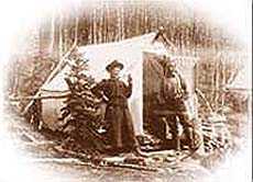
Otis,
however, had some problems. Otis’
arms ended at the elbow. He
had prostheses that he used, and used well, as he insisted on living as
normal a life as possible. Otis
began hanging around, and he bought a gold detector, and by working VERY
hard, he became proficient with it.
Not easy to swing a detector all day without an arm…
Otis found nuggets, but that big one that he wanted so badly
eluded him.
Well,
one fall Otis arrived in Quartzsite beaming from ear to ear. His face literally lit up the booth. He was so excited he could barely talk! It seems that they had gone to a place in Alaska on an
arranged vacation, and Otis had found a five-ounce nugget! He carried it with him in his shirt pocket, securely closed
by his wife with a large safety pin so he could not accidentally lose
it. When he saw someone he
had not told about it, he would tell them the story, ask them to open
his pocket, and take it out to show them.
Afterward he would ask them to return it safely to his pocket and
pin it securely again. I
don’t know how many times he got poked with that pin, but it didn’t
really bother him… he was walking on clouds.
Well, Otis made the cover of one of the treasure magazines, and
there were stories written up in a number of them.
He never returned to the Alaskan vacation place.
They had some problems, and I don’t know if they survived them.
While they were in operation I did not hear of anyone else making
any finds to compare with Otis’.
Otis was still detecting in winter when I left Quartzsite, and
for a number of years afterward, still beaming from that wonderful find
he had made in Alaska.
I’m
sure there are many of you who have heard of magnificent finds in
Alaska, and there have been many. I
wanted to come to Alaska to dredge, for many years.
When I finally came here, it wasn’t because of the dredging,
and although I have not done a whole lot of prospecting since I arrived,
I do stay in contact with a lot of people who are prospectors, so I have
made some observations and notes that will help anyone who IS planning
to make that dream a reality.
Remember
how places where gold is found are sometimes different? If your prospecting has been confined to the mother lode area
of California, you won’t find much difference.
However, if you go a bit further, to the Klamath River in far
northern California, you’re presented with a situation where you have
to change techniques. In
the mother lode, streams are confined to steep drops in rugged
mountains, and the gold is mostly found on or near bedrock, which is
pretty shallow. On the
Klamath, a much larger river, the gravels can be up to 30 feet deep, and
the gold that is mostly found is found within a “pay layer”
deposited by a flood. Most
of the gold found is of a small flake or small nugget variety, with
larger pieces being rare.
Well,
Alaska is another whole ball game.
And not only that, Alaska is soooooo large that there are several
different ballgames WITHIN the state!
First,
you have to really realize how HUGE the state is. I guess because when
you are in the “lower 48” about the only time you see the state of
Alaska it is separated on a weather map, and sitting down in the ocean
somewhere off the west coast, and is not done to scale so you really
have no idea of the size. Alaska
is two and a half times the size of Texas… Now that is big!
And the topography changes a great deal within the state, so
there are a number of very distinct and different areas.
Second,
another thing different about Alaska is that “there are no roads.”
That is local terminology, but it is very true that there are few
roads in the state, and many mining areas are either completely cut off
from road access, or the distances are so great that they are difficult
to get to. So, access to a
mining area is sometimes difficult, and it is not always possible to go
from one area to another. What you want to do, and where, needs to be
worked out ahead of time, or you may get up here planning to do
everything in your pickup and camper and need a plane to get where you
want to go, and spoil your whole trip.
Third,
just in case you are planning to camp out in a tent… if you are
picturing the forests of the western states, where you drive in, find
back roads near campgrounds and facilities like stores, gas stations,
etc., and can throw up a tent and dredge right outside your door, you
need to think again. That is not the reality of Alaska.
At least not anywhere near my area, and anywhere north of here.
The reality is this:
Much
of Alaska has already been made inaccessible to most of us. There are no roads or trails, and you can’t make them.
There are huge wilderness areas, large blocks of land which
belong to native corporations, and large blocks of land that are
government controlled to the point where access for recreational
prospecting is not possible. You
need to make sure that you can even do whatever it is you plan to do.
Now,
if you find out you CAN do whatever, and wherever, then you need to
realize that this is like no forest in the lower 48.
It even has a different name… it is a Boreal Forest, because of
the location, but what you are concerned with is the fact that I have
been on all of the major roads leading north from here, and it is hard
to imagine the miles and miles of unbroken forest, leading to the
horizon in every direction that goes on forever.
You get out of your vehicle and you are faced with an
impenetrable wall of forest at the road’s edge.
You can’t insert more than a hand in many places, let alone put
your body into it and walk. It requires a machete to hack a trail every step of the way.
Let me tell you… the men who first explored this land were
tough! And if you could
hack your way into it, or head up or down a river and get somewhere you
wanted to be, where would you be? How
long would you be able to stay there?
Could you survive? If
you were alone, and were in a tent, that is very debatable.
This is not like any area you have been in the lower 48 states.
It is not your world out there, it is a true wilderness where
animals are at home and you are the interloper… you are at the
disadvantage. You do not
know the game or the rules. The
game? It is survival, and
there are NO rules. If you
step into a bear’s territory, and he wants to, he will eat you.
If you face a moose and he is having a bad day, he will stomp
you. If you miscalculate
and don’t have enough food, or a bear chomps your gas cans or boat, or
any number of other things that can happen… and you can’t get out,
you will die. The sad fact is that people disappear in Alaska every year,
and no one ever finds them, no one ever knows what happened to them.
It is a very large place and wherever you are is a very
small spot, and most often unknown by anyone else.
The
first rule of Alaska is that you never go into the bush alone. Even
seasoned sourdoughs (those who are knowledgeable), do not go alone
without leaving word of exactly where, and how long, with someone with
the means to get them out. You
will be dependent on machinery, and it can break down, ALWAYS.
And even if not alone, you ALWAYS leave word, and keep in contact
with them. If you stay in a
tent, you have to know what you are doing.
There are a LOT of bears up here, and they are all hungry.
How many? No one has any idea.
It is a huge wilderness… a true wilderness.
Bears are territorial, and if you plunk yourself down in a
bear’s territory, well… or if he gets hungry and starts roaming and
there you are, well…
So
I am going to talk a bit about the area where I live, in the Fairbanks
area, and then tell you what I have learned about the other areas, in
talking with other prospectors here.
Jim and I put up an “Alaska Gold Forum” on our website, and
for the first time, prospectors from around the state are having some
contact with one another.
The
general topography of the Fairbanks, Livengood, and nearby mining
districts is of river valleys, and low rolling hills.
In the immediate areas around Fairbanks where gold has been
found, there are a number of very large mining companies, and there are
smaller ones, down to one-man operations. These are commercial
operations. There are no
recreational dredging areas within the city or the immediate area.
There are miles of tailings from large dredging operations, which
were successful, and the commercial operations are successful because
they can access the gold, which is deep.
Mostly 30 to 60 feet deep, and more.
There are several commercial panning operations in and around
Fairbanks where you are given a pan of material that they have removed
from deep inside a mine, and pan for a fee.
Because
there are no large mountains, steep drops to the creeks, etc., they do
not look like the creeks in the mother lode area of California. These creeks and rivers are meandering slowly, and twist and
turn constantly as they slowly make their way to larger rivers.
There are not large concentrations of big boulders, as there is
no fast water to move them.
The
first dredging water to the north of here is in the Chatanika River, and
in the area of the campground that is accessible to the road, it does
not look very promising. I
have not actually done any panning there, but no bedrock is in evidence,
nor large boulders. There’s
a lot of gravel. There are
other areas further up this river where access could be possible, mostly
created by hunters during moose hunting season.
The river runs fairly near the road.
We are going to check that out, and locate a gravel pit that a
prospector told us about. Finding
the right one is the problem… there are a lot of them, used to
construct the roads. And many of them are filled with at least some water during
part of the year.
Waders
are another necessity here for exploring.
Much of the ground is muskeg… it is not solid. It is tufts of grass sitting on pretty much “mush,” or
ground that has permafrost that melts at the surface in summer, so it
sinks when it is walked on. I
have not been in it… yet. We
have confined our walking to dry areas.
For
a newcomer, a book written by Ron Wendt, called “Where to Look for
Gold in Alaska Without Getting Shot” would be a necessity. Ron comes from a family of prospectors, and was born in the
Fairbanks area. He has
researched gold prospecting perhaps more thoroughly than anyone in the
state, and is a wealth of information, having worked most every mining
district from the fortymile down to the Anchorage area.
Ron gives you page after page of places that are highway
accessible, for a number of areas in the state, and rates them as to
what you can expect to find, what equipment can be used there, etc.
Further
north there are a number of large mining districts.
Near the top of Eagle Summit are Harrison and Mastodon Creeks
(now when I was dreaming of Alaska, I sort of featured Mastodon Creek as
about 5 miles outside Fairbanks… but it is actually too far to reach
in a day, do some prospecting, and get back home.
And the road, the Steese Highway, is mostly gravel.
While it is a good gravel road, the gravel is sharp, and it is
not unusual to hear of someone losing one, or even two tires on a trip.
It is pretty heavily traveled, as it is the only road to a number
of small towns to the north. Manley Hot Springs, indirectly, and Central and Circle
City direct, where the road ends at the Yukon River.
Harrison
Creek
and Mastodon Creek are in steep country, and Harrison Creek is
famous for nice nuggets, as is Mastodon.
We have a friend with a claim on Harrison Creek, and have worked
there a bit. As in most places, there is nowhere to work on either creek,
they are entirely claimed and worked very hard by a number of mostly
small commercial operations.
Further
north at Central, you can turn off to the Circle Mining District,
which is on the road leading to Circle Hot Springs.
GPAA has some new claims on Deadwood Creek there that we hope to
work this summer. From what
Ron says, and from the articles he has written about that area, it is
mostly worked with small commercial operations now also.
I gather that the best gold would be further up Deadwood Creek,
but he says there should be good areas possible on the claims.
Note: This area is
known for mosquitoes… you heard of them, of course.
The Alaskan mosquito, the state bird? (A local joke)
While I have not been back in to the claims, I have gone to the
miner’s picnic in Central, on a damp, rainy summer day when clouds of
them hovered around our heads. You
need to have plenty of “bug dope” before venturing out into the bush
in Alaska.
After
leaving Central, the ground gradually slopes down toward the Yukon
River, which is a very large river!
Where the road meets it at Circle City is one of the narrower
places, as it has been confined to a space between two bluffs.
Downriver from here it opens up to form many rivers, and gets
incredibly wide and spread out. There
is no road access to the Yukon after it leaves here, I don’t think.
There are native villages between here and the coast, and there
are still riverboats that supply them.
Their only other access to the outer world is by plane, or dog
sled in winter. They use
snowmachines to access other nearby villages, but not for long trips.
I did not see any evidences of mining in the Circle City area.
They may be there, but they are not evident from the highway, if
they are. The town was much
smaller than I expected. I
had only seen photos taken during the original development during their
gold rush, and it is smaller now than it was then.
Another
invaluable tool for someone coming to Alaska is “The Milepost.”
This large book covers every highway leading to Alaska from the
lower 48… it will take you all the way from the border there, to
Alaska, and then covers all major highways in Alaska and some in the
Yukon, mile for mile, telling you just what to expect from the highway,
and what can be found along the highway.
It is very good. Of
course it does not cover all the prospecting areas, or areas from a
prospecting angle. But it
is something I would not want to be without in unknown areas.
Other
mining districts to the north are partially accessible by the “haul”
road… this is the road used to access the oil pipeline.
The Brooks Range is an area to the north that is rich in
gold. It is NOT directly
accessible by road, however. The
people mining in the Brooks range fly in.
This area is hundreds of miles to the north of Fairbanks, and I
do not have any information on it.
It is not a recreational area.
The access is too difficult, and I don’t even know about any
other problems involved. The Koyukuk River has been mentioned by my husband on
his website, and in an article he wrote.
He has done a bit of prospecting there, and it is still dredged
in some areas. Some of it has been closed recently.
This area is about 200 miles north of Fairbanks by this gravel
road, and then you must have river transportation with you (there is
only a bridge there, no facilities anywhere), as it is several miles by
river to the dredging area he spoke of.
You must also be able to transport with you by river, your
prospecting equipment. The Wiseman
mining district is also up this road even further, and Coldfoot. There are rich mining districts in these areas, but the
mining districts are not accessible by road.
Towns are, but I don’t even have mileages at my fingertips
right now. They are a long
way. There are commercial
operations up there, some fairly large.
To
the southeast, on the Richardson Highway, is Delta Junction, and there
are some large mining operations in this area, but no recreational
prospecting that I am aware of.
Further
south we have begun to investigate the Black Rapids area. This is an area several hours south of us on the Parks
Highway, which leads to the coast at Valdez.
Valdez is about eight hours south of us by highway, depending on
what work is being done to the road.
To give you an idea, they say there are four seasons here…
almost winter, winter, still winter, and road construction.
Typically, they will be working on the road in several places,
all the time that construction is possible.
There are not many months of the year that the ground is not
frozen, and while it is, the elements are wreaking havoc to it.
So they have to repair it, every year.
It slows travel down during summer months.
This is a gorgeous drive, however, and there is tremendous fishing at
Valdez, in a most beautiful setting.
In
a mountainous area, at Black Rapids there are a number of small creeks
that tumble down steep mountainsides to flow right under the highway.
We had a little luck panning one, and less dredging another with
a small dredge, but after talking to Ron about them we think we can have
some better luck at others. There is a military facility in this area
that you must deal with. The
land continues to slope steeply from the highway to the river not far
below at the lowest point in this valley, and a glacier is seen flowing
from the pass on the other side of the valley.
There are a number of creeks flowing into the river from the
other side, also, but prospecting is not allowed there.
Full of glacial silt, the river is not suitable for dredging.
The water appears to have the consistency of gritty cocoa, and
the color is the grey of concrete in these glacial rivers and streams.
Although
the creeks are small most of the year, we checked them out right after
flooding last year, and they moved a whole lot of material at that time!
They were forced to do a lot of reconstruction to the area, and
the highway was closed for several days while they cleared away all the
debris that ended on top of it. Since
it is quite a distance it will take awhile to thoroughly check it.
We can do it in a day, but it does not leave us a very long day
working there. We may rig
up something so we can “overnight it” in our minivan, but may not be
able to do that this summer. We
have a lot of company coming this year.
Further
south on the Parks highway from Fairbanks, the mining areas are not far
from Anchorage. Anchorage is about seven hours by highway. There is the
Petersburg mining district, and/or the Yentna mining district (I
haven’t figured out yet if these are separate or one and the same),
which is in the mountains near Wasilla (about an hour this side of
Anchorage). There is some
dredging in this area, and Dennis Garrett, who has a commercial
operation, is offering prospecting trips, or fees, or claims or
something. You can often
ask for him on our forum and he’ll reply.
Or you can go to his website, and I’ve included that url on the
Prospecting page of this website.
Then,
to the south of Anchorage on the Sterling Hwy I believe, toward the
Kenai Peninsula, as you go around Turnagain Arm there is a mining
district to the left called Crow Creek, where a commercial
operation offers mining by the day on their claims.
This is a popular place for detectorists and dredgers and panners
in the area, and they sometimes can do quite well.
GPAA also has claims in this area, somewhere (on Mills
Creek?), that co be good. Near
the end of Turnagain Arm is a turnoff to Hope, to the right.
The Hope Mining company has commercial claims there, and
was offering mining packages to people, also.
I do not know anyone who has mined there.
It is rich in gold mining history, I just don’t have any
feedback on this company from anyone yet.
If anyone visiting this page does have firsthand knowledge…
have experienced it for themselves, could you please email me?
Thanks!
There
are hardrock mines in the steep mountains around Moose Pass,
going further south on the Sterling Highway.
Very steep country and stiffly regulated, I understand. I have a book all about gold mining on the Kenai Peninsula,
that was given to me by a friend there, Eric Treider. I have not read all of it yet, however, so I will hold off on
going any further south with my information.
I
do understand, from the dredgers who visit our gold forum, that in some
areas to the south of us, they prefer dredging in the winter, because
the water is too swift during summer months in some areas.
They have posted a lot of photos of dredging when deep snow is on
the ground. That is
dedication!


 it all.
 and the metal detecting companies first came out
with nugget hunting detectors during that time.
and the metal detecting companies first came out
with nugget hunting detectors during that time.